About This Destination
Originally a tow path for the Pennsylvania Main Line Canal, the trail has been transformed into a community treasure by the dedication of Rails to Trails of Central Pennsylvania Inc.
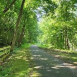
Stroll along the Lower (pronounced lau-er) Trail and keep an eye out for rare bird species in this important migratory bird area with beautiful river views. Originally a tow path for the Pennsylvania Main Line Canal, the trail has been transformed into a community treasure by the dedication of Rails to Trails of Central Pennsylvania Inc.
This Destination is managed by:
Rails to Trails of Central Pennsylvania
For more information about visiting this Destination, visit:
ADA Accessible
Details
- Distance of 1.68 miles
- 132ft ascent
- GPS link for this location:
- Lower Trail Williamsburg Station, 11 Juniata St., Williamsburg, PA 16693
- From the Rails to Trails of Central PA website:
- “The Lower Trail runs for almost 17 miles from near Canoe Creek State Park in Blair County northeastward to near Alexandria in Huntingdon County. The trail has a rolled crushed limestone surface except for a 2 mile asphalt section through the Borough of Williamsburg and running northeastward. The trail is extremely flat with only a slightly noticeable grade when riding from east to west. The Lower Trail is open year-round for hiking, biking, horseback riding, bird watching and photography and, in the winter months, cross country skiing and snowshoeing (any non-motorized use).”
- See more info and images of the trail here.
Maps
Get Directions